Introduction
Abdullah M. S. Al-Amri
Professor of Geophysics & Director of Seismic Studies Center
King Saud University – Riyadh
Introduction
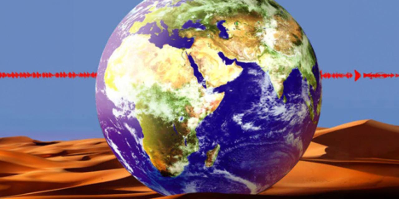
The Arabian Peninsula presents several interesting seismological problems. On the west, rifling in the Red Sea has split a large Precambrian Shield. Active rifling is responsible for the geometry of the plate margins in the west and southwest. To the south, similar rifling running in a more east-west direction through the Gulf of Aden has separated the Arabian Peninsula from Africa. In the northwest, the Gulf of Aqabah forms the southernmost continuation of the Dead Sea transform. The northern and northeastern boundaries of the Arabian Plate are areas of continental collision, with the Arabian Plate colliding with the Persian Plate.
The surface geological and tectonic settings of the Arabian Peninsula consist mainly of:
- The Arabian shield in the west.
- The Arabian platform in the east.
- Tertiary volcanism along the Red Sea coast.
- Red Sea and Gulf of Aqabah.
Arabian Shield
The accretionary evolution of the Arabian plate is thought to have originated and been formed by amalgation[U1] of five Precambrian terranes. These are the Asir , Hijaz and Midyan terranes from the western part of the Arabian shield, and from the eastern side of the shield are the Afif terrane and the Amar arc of the Ar Rayn micro-plate. The western fusion is along the Bir Umq and Yanbu sutures. The eastern accretion may have started by about 680-640 million years ago (Ma) when the Afif terrane collided with the western shield along the Nabitah suture. At about 670 Ma, a subduction complex formed west of Amar arc. Along this subduction zone, the Afif terrane and Ar Rayn microplate , collided and that lasted from about 640 to 620 Ma. .The north trending Rayn anticlines and conjugate northwest and northeast fractures and faults may have formed at this time (Figure 1).
The Arabian Shield is an ancient land mass with a trapezoidal shape and area of about 770,000 sq. km. Its slightly-arched surface is a peneplain sloping very gently toward the north, northeast, and east. The framework of the shield is composed of Precambrian rocks and metamorphosed sedimentary and intruded by granites. The fold-fault pattern of the shield, together with some stratigraphic relationships suggests that the shield have undergone two orogenic cycles. The first cycle was the Al Hijaz orogeny which was more intense and widespread aerially. East-west compression was dominant, so that strongly folded and faulted beds of the shield in the west-central part trend northeasterly, while in the southern portion trend generally northerly.
Following the formation of the Najd fault system, the Arabian shield remained a rather stable platform throughout the Paleozoic and Mesozoic except for several episodes of movement along older faults. The only major orogenic event which affected the region since early Cambrian was the deformation and magmatism associated with the Red Sea rifting. Recently, various speculations have indicated that the Arabian-Nubian shield formed through a process of arc and micro-plate accretion. On the basis of this interpretation, the evolution of the Arabian shield is in terms of 3 stages: (a) magmatic arc; (b) continental collision; (c) intra-cratonic[U2] .
Arabian Platform
The platform consists of the Paleozoic and Mesozoic sedimentary rocks that uncomfortably overlays the shield and dip very gently and uniformly to the E-NE towards the Arabian Gulf . The accumulated sediments in the Arabian platform represent the southeastern part of the vast Middle East basin that extend eastward into Iran, westward into the eastern Mediterranean and northward into Jordan, Iraq and Syria.
The Arabian shield isolated the Arabian platform from the North African Tethys and played an active paleogeographic role through gentle subsidence of its northern and eastern sectors during the Phanerozoic, allowing almost 5000 m of continental and marine sediments to be deposited over the platform. This accumulation of sediments represents several cycles from the Cambrian period onward and forms now a homocline dipping very gently away from the Arabian shield.
Several structural provinces can be identified within the Arabian platform : 1) An interior homocline in the form of a belt, about 400 km wide, in which the sedimentary rocks dip very gently away from the shield outcrops. 2) An interior platform, up to 400 km wide, within which the sedimentary rocks continue to dip regionally away from the shield at low angles. 3) Intra-shelf depressions, found mainly around the interior homocline and interior platform.
Unfortunately, no locally recorded earthquake data have been used to determine the crustal characteristics of the Arabian platform.The regularly spaced north trending Summan platform, Khurais-Burgan and En Nala-Ghawar anticlines, and Qatar arch in the eastern part of the Arabian plate appear to have formed during the Precambrian Amar Collision about 640-620 million years ago (Ma).
The Sinai triple junction is composed of the Najd fault system, the Egypt rift, the Jordan valley, and Derik rift. During the final extensional stage about 530-570 Ma, the northwest trending Najd fault system dislocated the Arabian shield left laterally by about 250-300 kilometers. This dislocation appears to compliment the northeast oriented intra-continental rifts in Oman, Zagros Mountain, and the Arabian Gulf. These rift basins accumulated thick sequences of clastic and carbonate rocks and salt such as the Ara group in Oman, Hormuz series in the Arabian gulf and Zagros mountain. During the extensional collapse, the north trending anticlines probably remained elevated as elongated horst bounded by normal faults.
Tertiary Volcanism
Two distinct phases of continental magmatism are evident in western Saudi Arabia. The first phase produced tholeiitic-to-transitional lavas emplaced along NW trends from about 30 to 20 Ma. The second phase produced transitional-to-strongly alkalic lavas emplaced along NS trends about 12 Ma. The first phase is attributed to passive-mantle upwelling during extension of the Red Sea Basin, whereas the second phase is attributed to active mantle upwelling but was facilitated by minor continental extension perpendicular to plate collision . The second phase is largely contemporaneous with a major period of crustal uplift to produce the West Arabian swell. The central axis of the uplift and magmatism of the Arabian swell is symmetric and coincides with two fundamental features which are the Ha’il-Ruthbah Arch in the north and the Makkah-Madinah-Nafud volcanic line in the south. Volcanism was widespread in western Saudi Arabia during the Tertiary Period. The oldest lavas, called the Trap Series rest on Cretaceous clastic in Yemen where these are associated closely with the Rifting of the Red Sea.
| Fig. 1: Location and major tectonic elements of the Arabian plate and Iran. The Makran and Zagros separate the Arabian plate from the microplates of interior Iran. |
Red Sea and Gulf of Aqabah
The Red Sea is an 1800 km elongated trough trending NW-SE from the Sinai Peninsula in the north down to the Strait of Bab Al Mandeb in the south. The Red Sea can be divided into two main physiographic units. These are: (a) the shelf area which is composed of the coastal area and the marginal shelves, (b) the main and axial trough. The shelf is narrow in the north and wide in the south, whereas the trough is wide in the north and narrow in the south.
Structurally, the Red Sea is a graben along the crest of an anticline that formed in the Arabian-African Shield. The inner margins of the shield apparently undergo considerable uplift that formed prominent scarps at the edge of the Red Sea rift. A zone of 1-2 km. in width that is composed of high and tensional faults concealed by coastal sediments lies at the foot of the escarpments. On the seaward side of this zone, the basement has been step faulted downward in blocks and lies beneath the shelf area at a depth of 2-3 km below sea level .
Three sets of faults seem to have controlled the development of the Red Sea. These were the NW-SE trending main line of faults which are associated with step faulting and the WNW-ESE major fault trend in the Precambrian basement which caused many irregularities in the coastline.
The regional distribution of seismicity in the Red Sea indicates concentrated distribution of events proximal to the main and axial trough in the southern portion. However, the concentration is not uniformly distributed, but occurs in clusters on the ridge crests, or near transform faults of the rift axis. Other significant activities appear to occur along other portions of the central rift not having transform faults. The activities may be related to intrusive mechanism, normal fault movements associated with the down dropping of blocks, or movements along undetected transform faults. Focal mechanisms for two earthquakes located near the southern Red Sea rift axis indicate nearly pure strike-slip mechanism on NE trending planes that suggest seismic activity on rift transform faults.
The Gulf of Aqabah forms the southern part of the Levantine transform fault. This fault forms the boundary between the Arabian and African plates. The fault is composed of 4 straight segments. The first is along the Aqabah and Araba that trends N15E. The second runs along the Dead Sea, Jordan and Hula Valley. The third passes through the Beka’a and Orontes valley, and from Orontes the transform extends up to the Taurus-Zagros thrust. With a total of 105-110km dominant left lateral shear, minor components of extension, compression and up-warping occur in many places. Normal faults were generated along the margins of the transform due to these systems with variable displacements in the localities of these faults.
Seismicity & Crustal Structures
The northwestern regions of Saudi Arabia are distinct from the Arabian Shield, as this region is characterized by high seismicity in the Gulf of Aqabah and Dead Sea Rift. Active tectonics in this region are associated with the opening of the northern Red Sea and Gulf of Aqabah as well as a major continental strike-slip plate boundary (Figure 2).
The Dead Sea transform system connects active spreading centers of the Red Sea to the area where the Arabian Plate is converging with Eurasia in southern Turkey. The Gulf of Aqabah in the southern portion of the rift system has experienced left-lateral strike-slip faulting with a 110 km offset since early Tertiary to the present. The seismicity of the Dead Sea transform is characterized by both swarm and main shock-aftershock types of earthquake activities. The instrumental and historical seismic records indicate a seismic slip rate of 0.15-0.35 cm/year during the last 1000-1500 years, while estimates of the average Pliocene-Pleistocene rate are 0.7-1.0 cm/year.
Previous seismicity studies in the Gulf indicate a relatively lower seismic activity. However, lately there were recent seismic activities that have occurred. These were the 1983 sequence that lasted about 2 months and associated with a maximum magnitude (Mm ax) of 5.2. In April 1990 and in May 1991 which have peak Mm ax of 4.3 respectively were another 2 set of earthquake sequences that have occurred. These two swarms indicate a spatial overlap with the southern part of the 1983 events, suggesting the 1983, 1990, and 1991swarms were a part of one tectonic segment and activity in the Elat deep. The sequences were followed later by the 1993 event which was located in the Aragonese Deep with Mm ax of 5.8. The latest earthquake of concern that is located also in the Aragones Deep is the 1995 event with Mmax of 7.1, which is the strongest among the events that has occurred in the gulf.
Seismicity activities in the Gulf of Aqabah have been dominated by earthquake sequences lasting for about 1-3 months, with a clear pattern of spatial distribution that cover a specific tectonic segment. Each segment is observed to go through a seismic swarm cycle. Interaction between segments influences the time period of their cycle.
Historically, the most significant earthquakes to hit the Dead Sea region were the events of 1759 (Damascus), 1822 (Aleppo), and of 1837 ;1068 (Gulf of Aqabah area) caused deaths of more than 30,000 people. About 26 major earthquakes (6.1<ML<7.3) occurred in southern Dead Sea region between 2100 B.C. and 1900 A.D. In 1980’s and 1990’s, the occurrence of earthquake swarms in 1983, 1985, 1991, 1993 and 1995 in the Gulf of Aqabah clearly indicates that this segment is one of the most seismically active zones in the Dead Sea transform system. Earthquake locations provide evidence for continuation of faulting regime from the Gulf northeastward inland beneath thick sediments, suggesting that the northern portion of the Gulf is subjected to more severe seismic hazard compared to the southern portion.
Seismic activity in the Arabian shield appears to be low. There were only few moderate seismic events composed of 25 (4.0<Ms<5.9) and 1 (Ms>6.0) to have occurred since 1900. However, historical accounts indicated that strong ground shaking has been felt in the northwestern portion of the shield during the 1068 event (Ms7.0) and 1588 event (Ms6.7). The Ms(7.0) was accompanied by ground cracking and fissuring that caused widespread destruction. The central portion was also shaken in the year 1269 which was felt at Taif. This earthquake was associated to the activity of the right lateral NE trending Ad Damm fault which passes close to Taif. In 1256, the City of Madinah also experienced ground shaking. However, the shaking phenomenon was more related to volcanic activity than other events.
In contrast to the scarcity of information regarding earthquakes in the northern and central portion of the shield that has affected the population, there is a continuous document of felt, strongly felt, and destructive earthquake occurrences in Yemen since the year 742. The location of these earthquake events are primarily distributed in the Yemen Trap Series. The 13 of December 1982 Dhammar earthquake (Ms6.1) killed 2,000 people, destroyed 300 villages, and rendered 700,000 homeless.
To the south, the majority of earthquakes and tectonic activity in the Red Sea region are concentrated along a belt that extends from the central Red Sea region south to Afar and then east through the Gulf of Aden. There is little seismic activity in the northern part of the Red Sea, and only three earthquakes have been recorded north of latitude 25o N. Instrumental seismicity of the northern Red Sea shows that 68 earthquakes (3.8<mb<6.0) are reported to have occurred in the period from 1964 to 1993 .
Historically, about 10 earthquakes have occurred during the period 1913-1994 with surface-wave (Ms) magnitudes between 5.2 and 6.1. Some of these events were associated with earthquake swarms, long sequences of shocks and aftershocks (the earthquakes of 1941, 1955, 1967 and 1993). The occurrence of the January 11,1941 earthquake in the northwest of Yemen (Ms = 5.9) with an aftershock on February 4, 1941 (Ms = 5.2), the earthquake of October 17, 1955 (Ms = 4.8), and the 1982 Yemen earthquake of magnitude 6.0 highlight the hazards that may result from nearby seismic sources and demonstrate the vulnerability of northern Yemen to moderate-magnitude and larger earthquakes. Instrumental seismicity of the southern Red Sea shows that 170 earthquakes (3.0<mb< 6.6) are reported to have occurred in the period 1965-1994. The historical and instrumental records of strong shaking in the southern Arabian Shield and Yemen (1832; 1845; 1941; 1982 and 1991) indicate that the return period of severe earthquakes which affect the area is about 60 years.
The Arabian Plate boundary extends east-northeast from the Afar region through the Gulf of Aden and into the Arabian Sea and Zagros fold belt. The boundary is clearly delineated by teleseismic epicenters, although there are fewer epicenters bounding the eastern third of the Arabian Plate south of Oman. Most seismicity occurs in the crustal part of the Arabian Plate beneath the Zagros folded belt. The Zagros is a prolific source of large magnitude earthquakes with numerous magnitude 7+ events occurring in the last few decades. The overall lack of seismicity in the interior of the Arabian Peninsula suggests that little internal deformation of the Arabian Plate is presently occurring.
The overall lack of seismicity in the interior of the Arabian Peninsula suggests that little internal deformation of the Arabian plate is presently occurring. There is widespread Quaternary volcanism along the Red Sea coast, with at least one documented historical eruption in 1256 A.D. Some seismicity was associated with that eruption. Seismicity may also be related to transform faults in the Red Sea continuing onto land as well as other causes. To date, few on-land epicenters are accurately located and there are few focal mechanisms available.
The Saudi Arabian Broadband Deployment provided the first data set of broadband recordings of this region. This deployment consisted of 9 broadband three-component seismic stations along a similar transect an early seismic refraction study. Data from the experiment resulted in several studies and models. These studies provided new constraints on crustal and upper mantle structure. The crustal model of the western Arabian Platform shows a little higher P-velocity for the upper crust in the Shield than in the Platform and the crustal Platform seems to have a greater thickness than in the Shield by about 3 km.
Seismographic Networks in Saudi Arabia
There are two independent analog seismic telemetry networks in Saudi Arabia. King Saud University (KSU) network features 31 stations. King Abdulaziz City for Science and Technology (KACST) operates a network of three-component broadband and short-period stations. Both networks have stations throughout the Kingdom of Saudi Arabia, but the station density is greater near the Gulf of Aqabah. These networks recorded the shots with good signal-to-noise above about 0.5 Hz. Recently, KSU and KACST networks run the Boulder Real Time Technologies (BRTT) Antelope System as described below.
ANTELOPE is a system of software modules that implement acquisition, transport, buffering, processing, archiving and distribution of environmental monitoring information. Antelope is a distributed, open-architecture, UNIX-based acquisition, analysis and management system. It consists of two major sub-systems, namely Antelope Real Time System (ARTS) and Antelope Seismic Information System (ASIS).
KSU Seismographic Network
The King Saud University (KSU) seismological network was established in 1985 and includes the digital WWSSN station in Riyadh. Currently, the network consists of 31 stations with denser sub-networks in the Gulf of Aqabah region (12 stations) and the southwestern part of Saudi Arabia (8 stations). The seismographic station in Riyadh is a 6 – channel station and consists of three S-13 short-period and three SL-200 long-period seismometers. The seismometer outputs are amplified, filtered and recorded in both analog and digital form. The filters allow recording in four different periods (SP wide band, SP narrow band, LP wide band and LP narrow band). The total system response for the Riyadh station is broadband (0.01 to 33 Hz). Signals from the 9 channels are also routed to a 12-bit A-to-D converter and recorded on 9-track magnetic tapes. The other telemetered seismic stations are equipped with S-13 short-period seismometers connected to a field case housing an amplifier, a voltage controlled oscillator (VCO), an automatic daily calibrator and a telemetry interface.
KACST Seismographic Network
In May 1998 King Abdulaziz City for Science and Technology (KACST) began operating the seismic network. It consists of 38 stations mostly distributed across the Arabian Shield (western Saudi Arabia, Figure 3). The instrumentation features 27 broadband and 11 short-period instruments. All stations record three-component ground motions at a sample rate of 100 samples/second. The stations operate continuously and transmit data in real-time to the KACST Headquarters building in Riyadh. The KACST Data Center receives the raw waveform data and runs the Boulder Real Time Technologies (BRTT) Antelope System. This is a software package for managing real-time seismic network data and performing the basic network operations of detection, association and location of events as well as data archival. A short-term average-to-long-term average (STA/LTA) energy detector runs continuously and detects phase arrivals. The system attempts to locate the event if a number of arrivals are detected by the network within a specified time window.
SGS National Seismographic Network
In 2005, The Saudi Geological Survey (SGS) began operating the national seismographic network in Jeddah, Saudi Arabia. It consists of 27 broadband stations distributed across the Arabian Shield and Platform. SGS broadband seismic stations consist of Nano metrics Trillium broadband seismometers, 24-bit digitizers, GPS receivers, and VSAT transceivers. The current VSAT being used is a private or closed system that uses TDMA (time-domain multiple access) for satellite channel sharing on ARABSAT-2B and UDP/IP communication protocol for data transmission and commands to remote stations. Data from remote sites are transmitted to satellite then to the SGS master station (HUB) in Jeddah. The satellite channel usage is managed via commands from the SGS seismic center. The Ku band for the SSPB (solid-state-power-block or transmitter final stage and up frequency converter) and LNB (low-noise-block or receiver) is susceptible to rain fade and thus a provision for lost packets is required. In addition to data recovery and remote sensor calibration, the VSAT system allows configuration of remote sites via a lower data rate TDMA channel. The present Ku band VSAT system has proven to be quite robust and operates well even in severe dust storms.
All seismic data (45 channels) from 15 remote seismic stations are received by the master VSAT station (HUB) at the seismic center in Jeddah. At present several servers (SUN workstations and PC workstations) are dedicated to network management software that put all data in ring buffers for access by client programs such as event detection and picking programs.
Figure 3. Tele seismic data from four different seismic arrays were used in this study (KACST, IRIS-PASSCAL, Jordan and UAE).
[U2]Tertiary volcanism along the Red Sea coast.


Hi, this is a comment.
To get started with moderating, editing, and deleting comments, please visit the Comments screen in the dashboard.
Commenter avatars come from Gravatar.